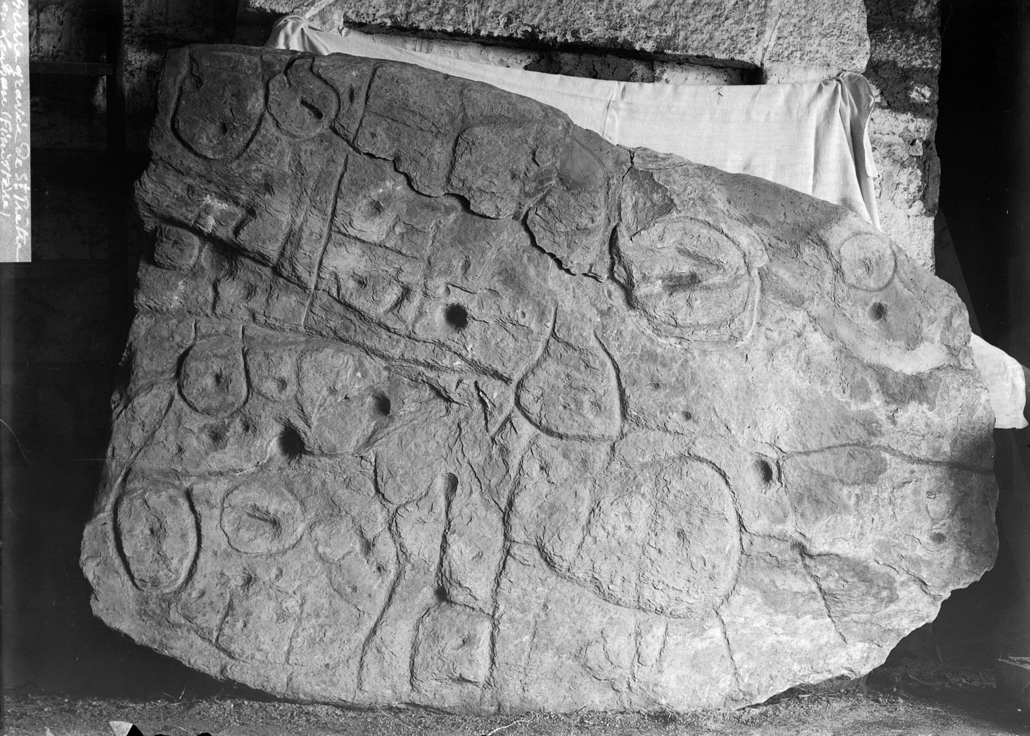
The Discovery of the Unique Slab in Brittany
Over a century ago, archaeologists working in the western part of Brittany, France, unearthed a unique stone slab inscribed with circular designs and hollows.
Source: Wikimedia
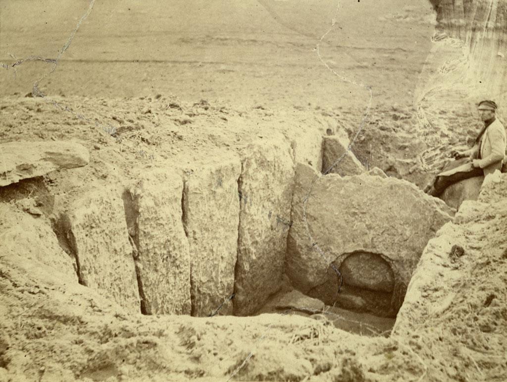
Paul du Châtellier discovered the item at an ancient burial ground, where the stone formed part of a Bronze Age structure. du Châtellier initially kept the item in his home, but eventually, it made its way into the hands of the National Archaeological Museum.
Researchers Didn’t Understand the Item's Significance
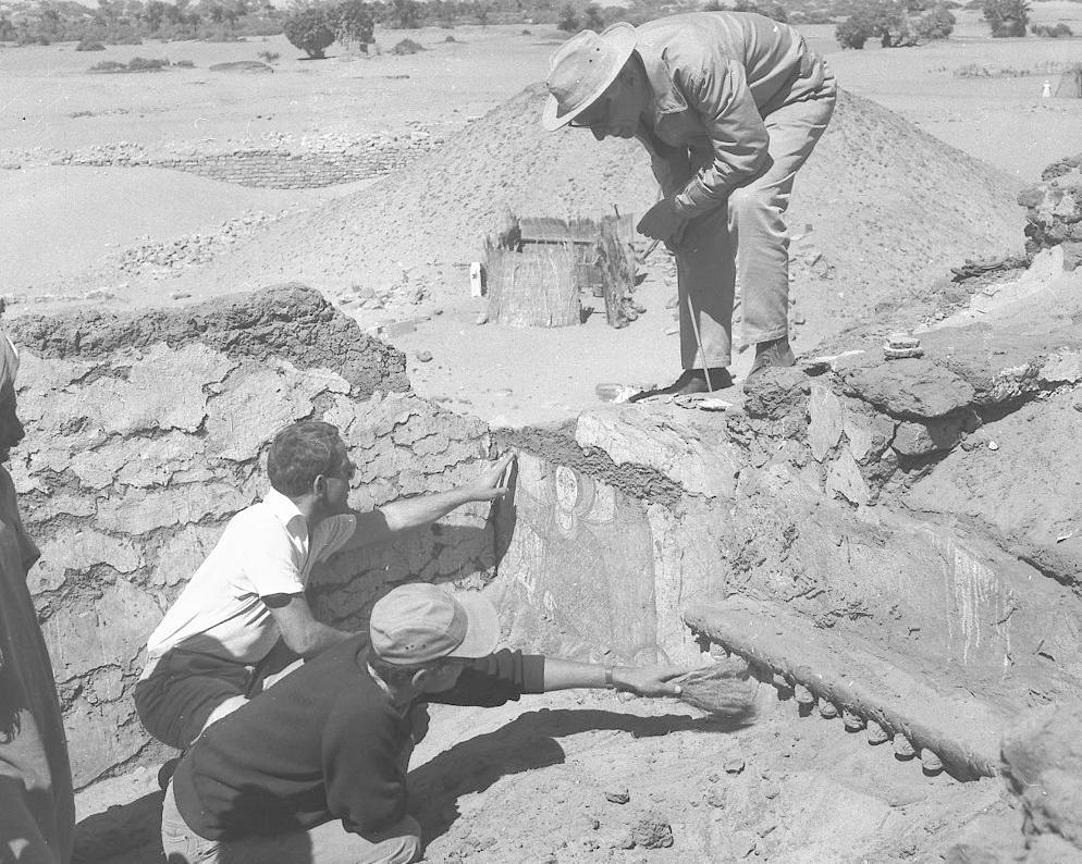
During its initial discovery, over a dozen workers were required to move the enormous stone slab from the burial site.
Source: Wikimedia
Unfortunately, du Châtellier didn’t recognize the significance of the stone artifact, so it didn’t receive a thorough examination when it was first discovered in the early 1900s.
Rediscovery of the Item in a French Castle
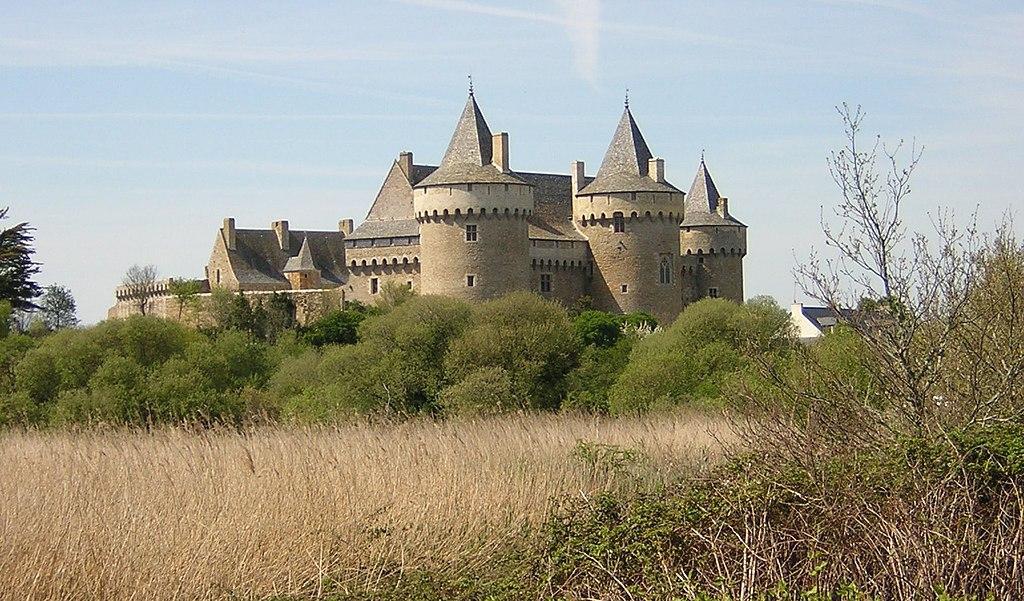
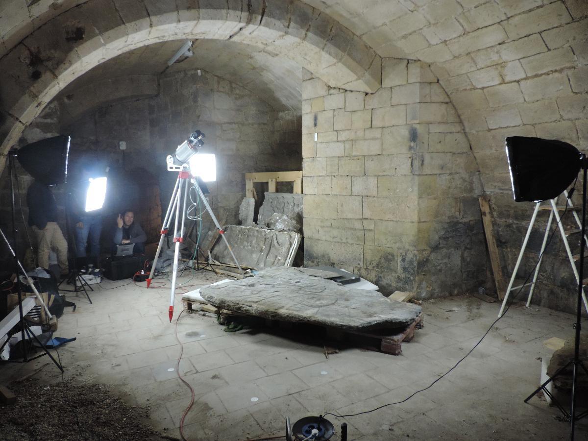
The unique artifact remained hidden in the cellar of the French Castle until it was rediscovered in 2014.
Source: Wikimedia
Following this, researchers from French and British universities meticulously examined the artifact, concluding it was made between 1900 and 1600 BCE, per The Independent.
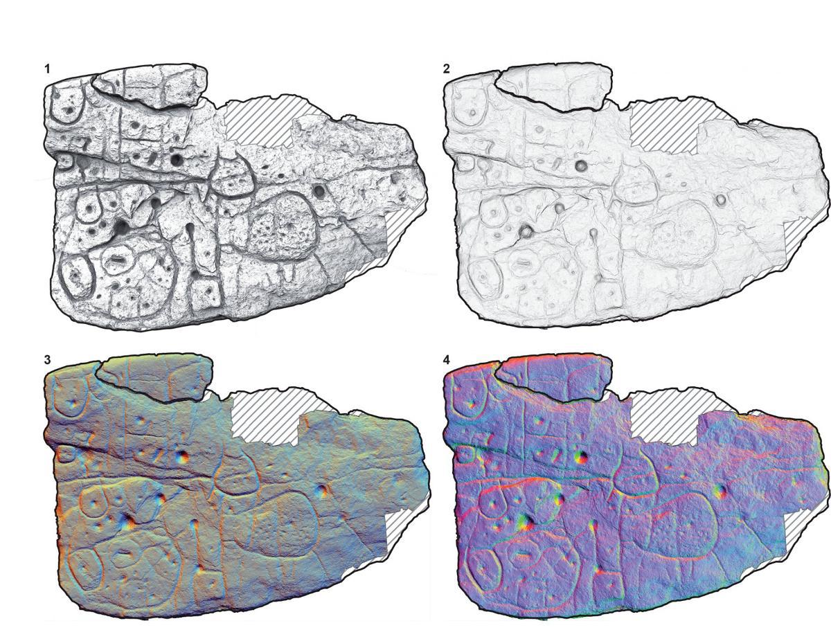
The Oldest Known Map in Europe
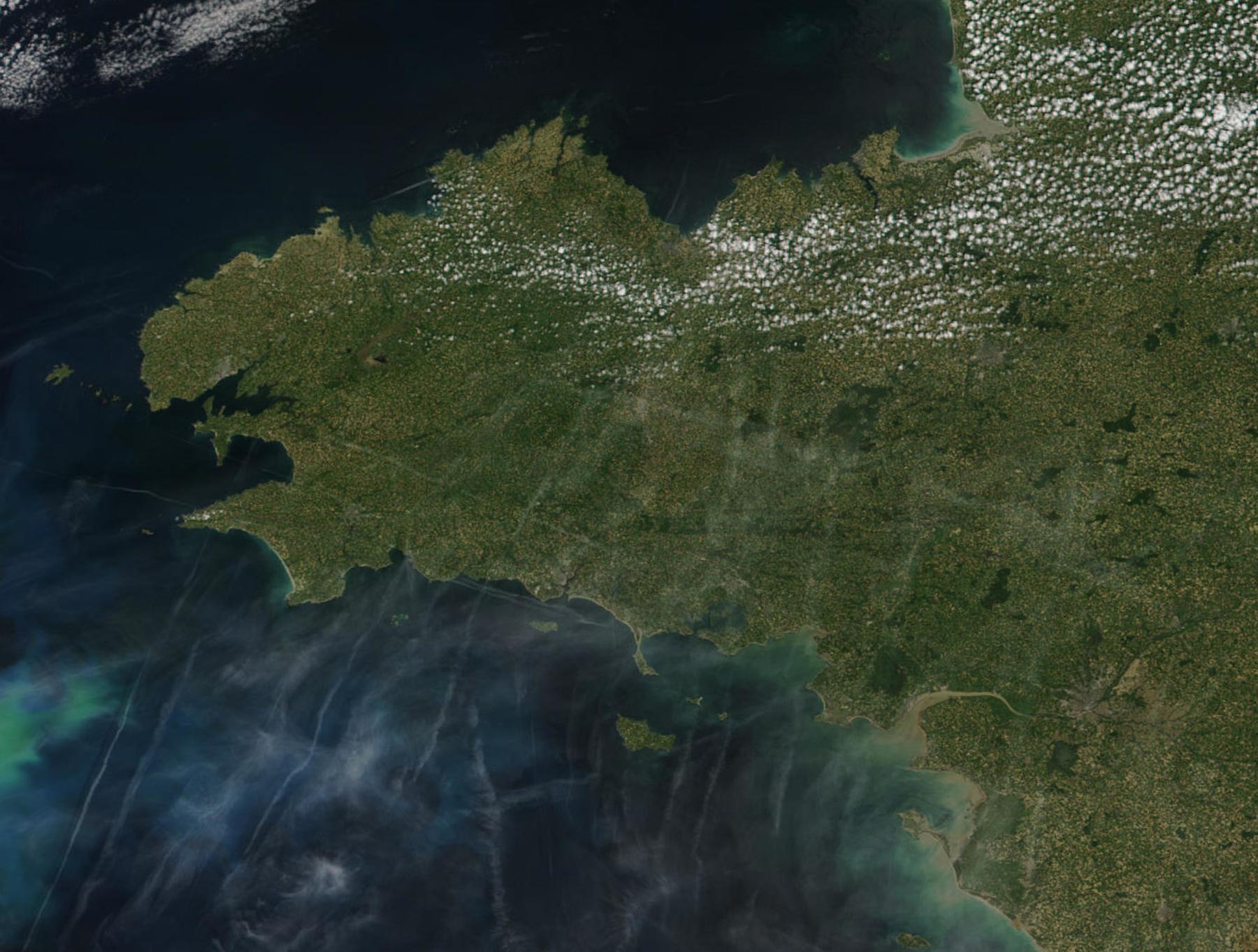
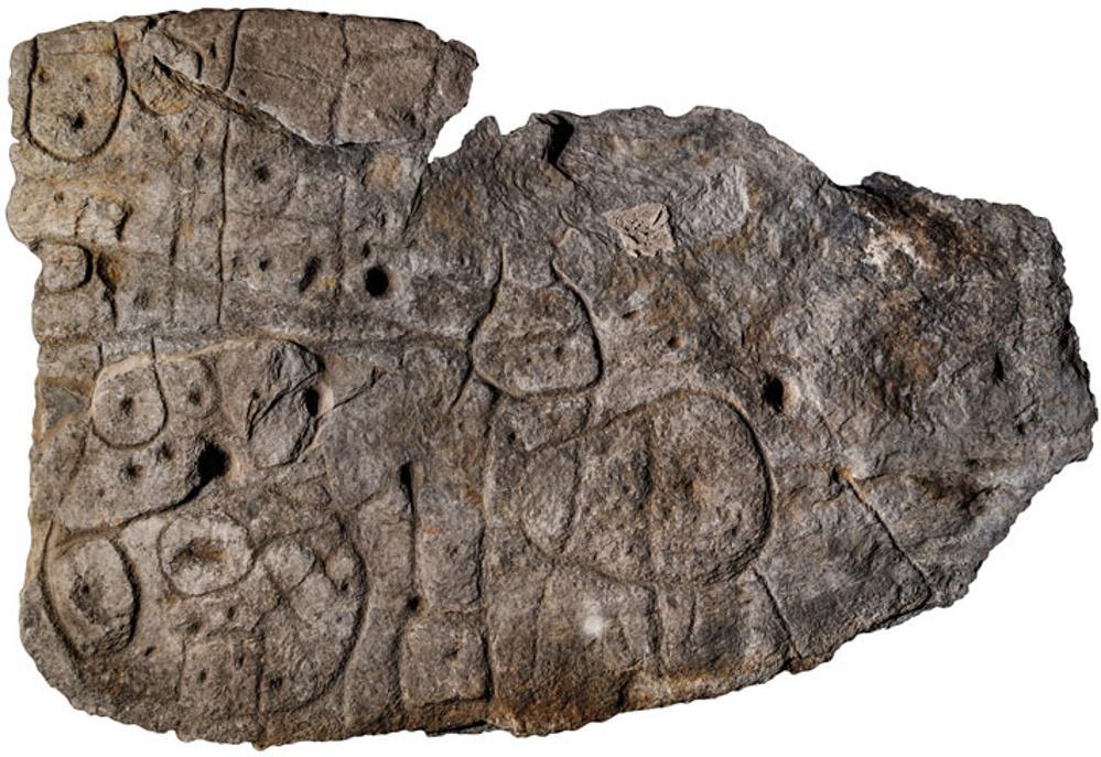
The researchers were fascinated to learn that the stone slab, which measured approximately 5 feet by 6.5 feet in size, was an early Bronze Age map of part of the Odet Valley in Western France.
Source: Dennis Gliksman INRAP
According to researchers, the stone slab is now considered the oldest 3D map ever discovered in Europe.
Uncovering the Secrets of the Stone
Speaking on how they identified the stone as a map, researchers explained that the course bumps and lines engraved into the stone appeared to resemble the mountains and rivers of Roudouallec.

Source: Freepik
“We still have to identify all the geometric symbols, the legend that goes with them,” said Nicolas.
Bronze Age Map May Lead Researchers to Unidentified Sites
Researchers believe the carvings on the rock may provide them with the location of several previously unidentified sites in this part of Brittany.
Source: INRAP/X
“Using the map to try to find archaeological sites is a great approach. We never work like that,” said Yvan Pailler, a professor at the University of Western Brittany (UBO), who called it a “treasure map.”
Researchers Continue to Learn More About the Slab
The face of the stone slab contains the usual hollows, which some archaeologists have postulated may indicate burial mounds or small settlements in the region.
Source: Wikimedia
Despite their theories surrounding the stone, Pailler explains there is still more to learn, and the researchers are “trying to better contextualize the discovery.”
Cross-Referencing the Slab With the Valley
The researchers determined that the map covers an area of roughly 30 by 21 kilometers in the Odet Valley.
Source: Wikimedia
According to Clement Nicolas from the CNRS Research Institute, properly surveying the entirety of the territory and comparing it to the markings on the slab may take several decades.
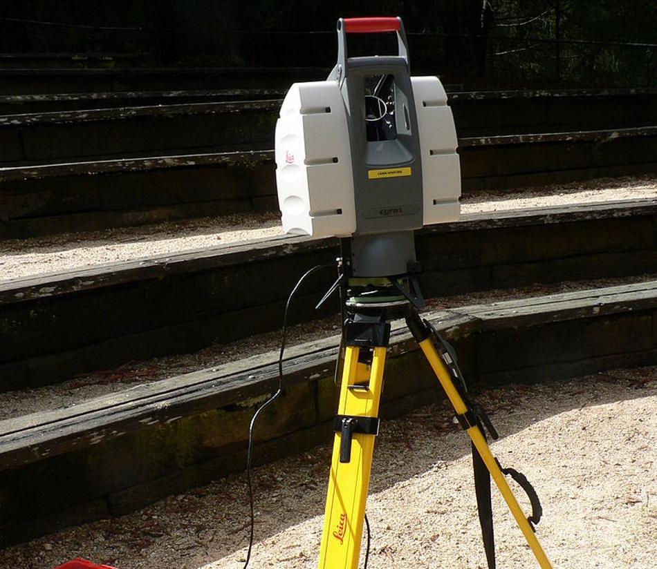
How Ancient Sites Are Typically Discovered
In the modern era, ancient sites are typically discovered using aerial photographs, sophisticated radar equipment, or Light Detection and Ranging (LIDAR).
Source: Wikimedia
However, the stone artifact has provided researchers with “a treasure map,” said Pailler, which may lead them to the ruins of ancient sites in the surrounding area.
Why the Slab Was Reused in a Burial Cist
According to the researchers, the map may have once determined the ancient boundaries of a Bronze Age kingdom.
Source: Wikimedia
“The engraved slab no longer made sense and was doomed by being broken up and used as building material,” said Nicolas.
The Search for Sites Continues
Speaking with Newsweek about the find’s importance, Nicolas explained, “This stone map is important because, for the first time, we have been able to demonstrate statistically its cartographic content.”
Source: INRAP
As researchers continue to study the map, there is a good chance they will locate several archaeological sites in the surrounding region and quite possibly several hoards of Bronze Age artifacts that could shed light on the ancient inhabitants that once lived in this part of Brittany, sparking a new era of discovery in the field of archaeology.