A Pope, a Prince, and a Painter
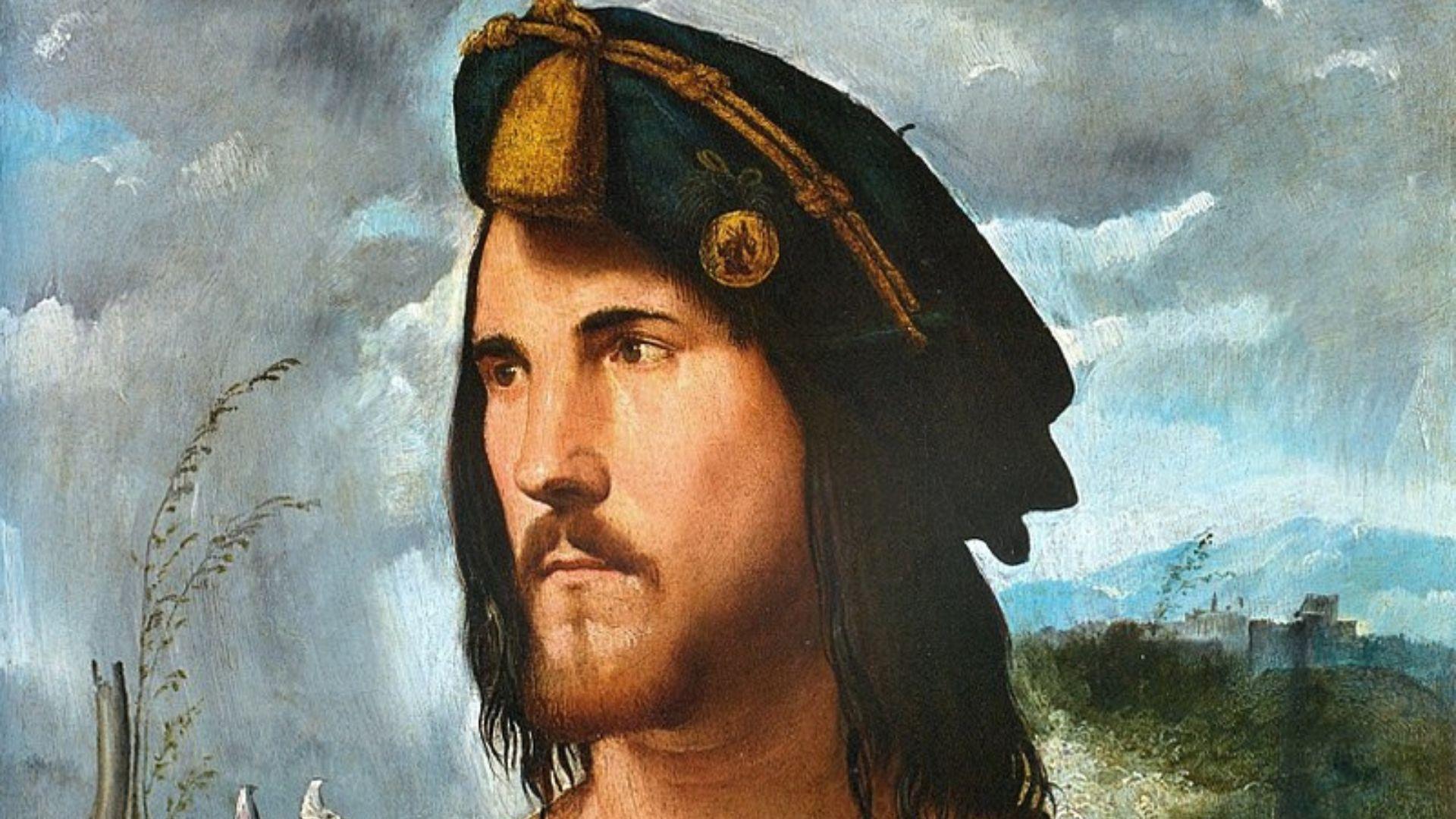
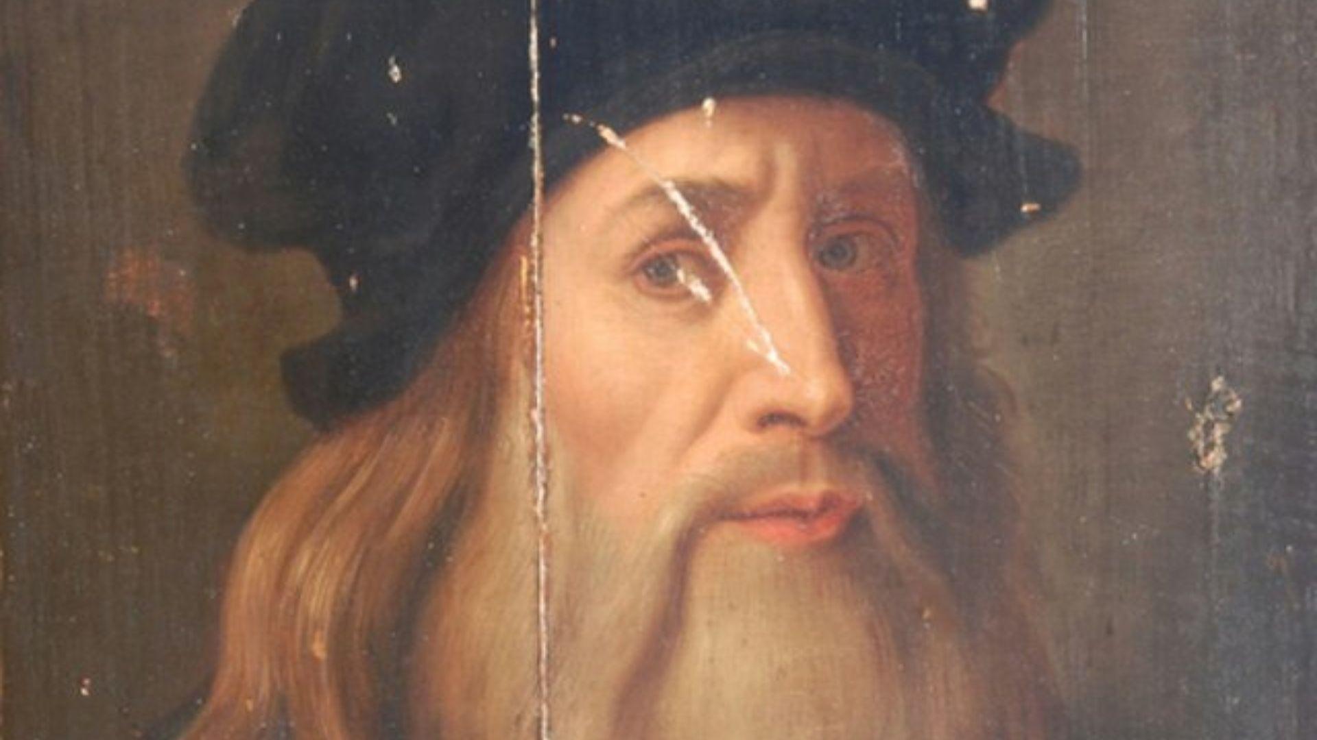
In 1502, Leonardo Davinci was in the service of the famous Cesare Borgia. Cesare was the son of Rodrigo Borgia – also known as Pope Alexander VI.
Source: Wikimedia Commons
A politician and member of the noble house of Borgia, Cesare was known throughout Italy for his sharp intelligence and military skill. In fact, his struggle for power would soon be the inspiration for Niccolo Machiavelli’s The Prince.
From Artist to Architect
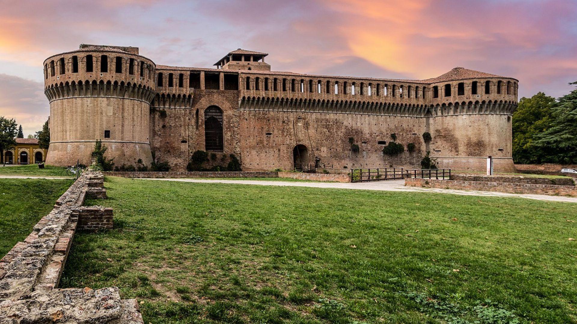
DaVinci travelled with Cesare Borgia to Imola in 1502, which had been under Borgia control since 1499.
Source: Wikimedia Commons
During that time, DaVinci likely created the map of the town to help Borgia familiarize himself with the territory. This would earn DaVinci the role of military engineer and architect under Borgia.
The First of its Kind
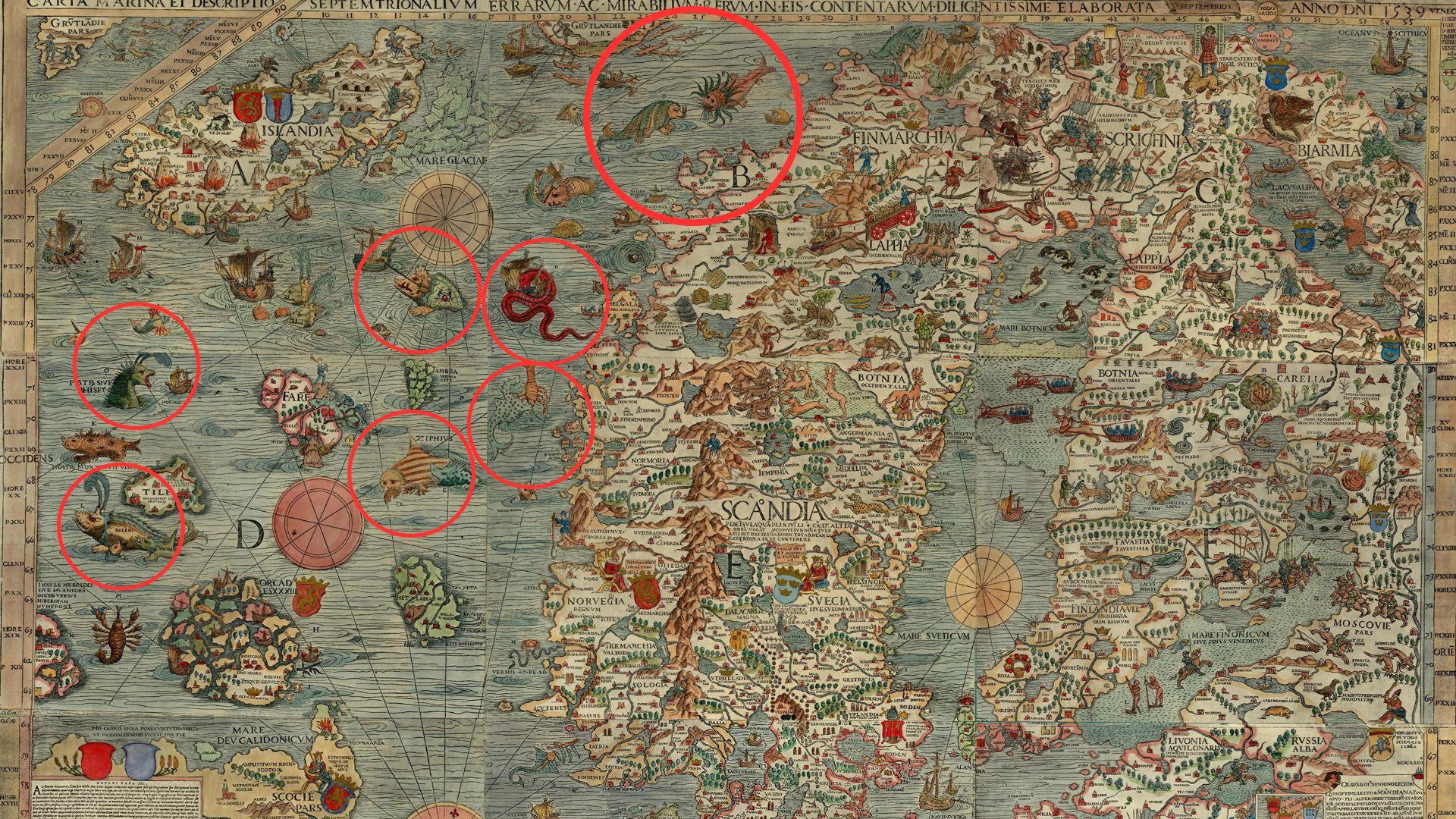
In Medieval and Renaissance Europe, map designs typically prioritized artistry over accuracy, often featuring images of mythical creatures. DaVinci set out to do something much more difficult – and much more useful.
Source: Wikimedia Commons
The Plan of Imola is the first ever ichnographic map, meaning it provides the viewer with an accurate top-down perspective. Most maps at the time were drawn at an angle, as viewed from a nearby hill.
Unprecedented Accuracy
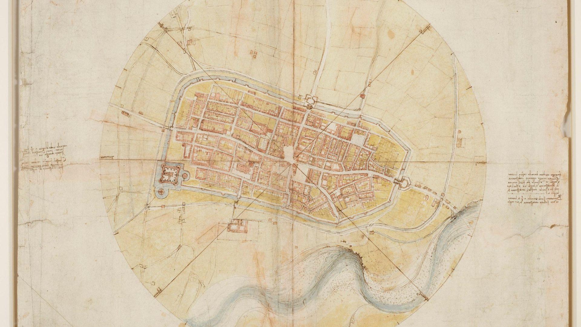
By focusing on mathematical accuracy, DaVinci created a map that was both visually pleasing and geographically precise. This provided immense military value for Cesare Borgia – hence the decision to make DaVinci his official military architect.
Source: Royal Collection Trust
Sure, DaVinci’s map wasn’t necessarily 100% accurate, but it was far ahead of any other Renaissance cartographer. He effectively set the standard for map-making moving forward.
The Making of an Impossible Map
To truly understand the town he was going to map out, DaVinci took to the streets. Using documented surveys of the town and his own measurements, he pieced together a detailed plan of the fortress of Imola.
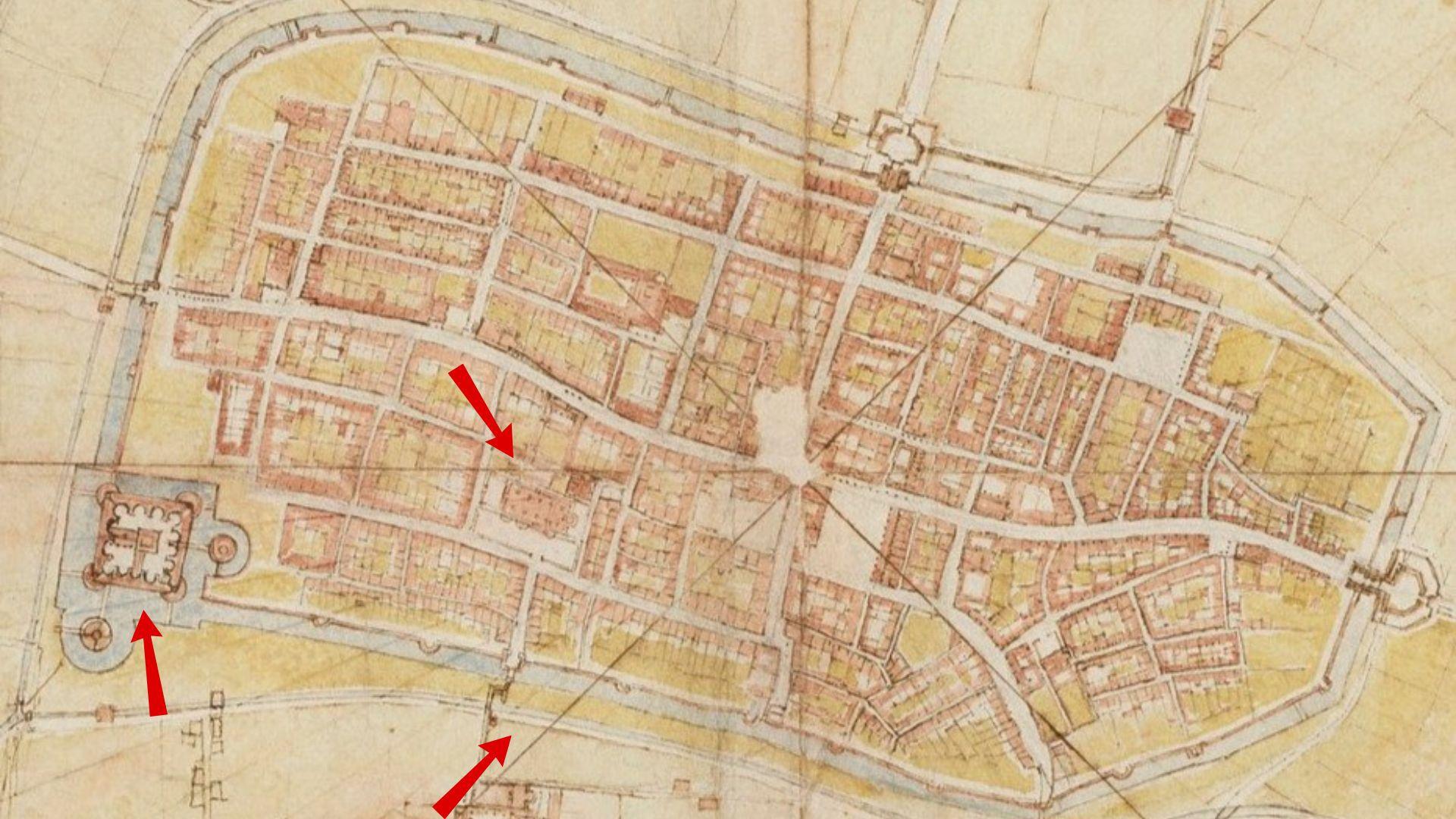
Source: Royal Collection Trust
The finished map features every building in Imola depicted in the circular design of a compass. DaVinci even included the moat surrounding the fortress and the river outside the city walls.
A Map for the Ages
DaVinci’s map was so accurate that it can still be used to get around Imola today. Comparisons with modern maps made using actual satellite technology show just how genius Leonardo’s methods truly were.
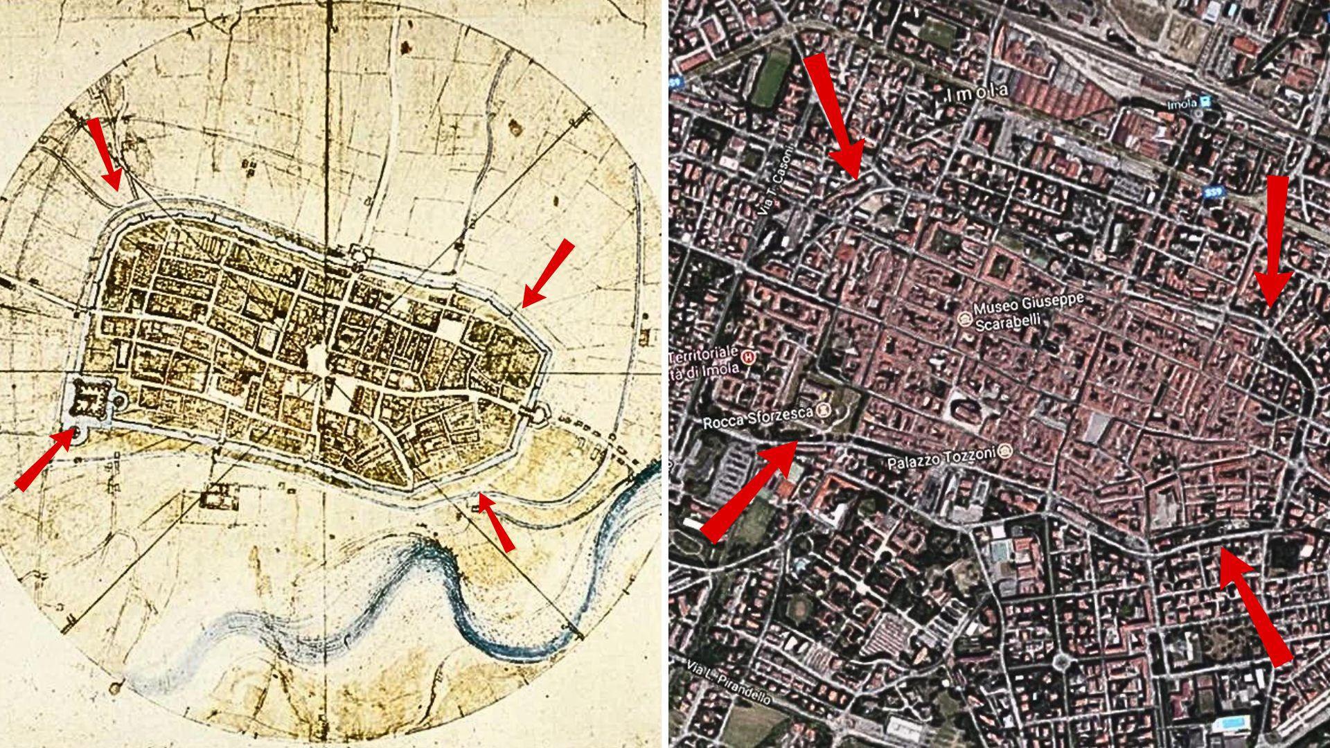
Source: Reddit
DaVinci had no way of knowing whether his map was a mathematical success – although it was certainly accurate enough to provide a military advantage. Only now can we fully appreciate his work.
More Than Just Math
DaVinci’s map of Imola represents the perfect balance of geometry and artistry. He used bright colors now faded, including shades of greens and blues in the landscape surrounding the town walls.
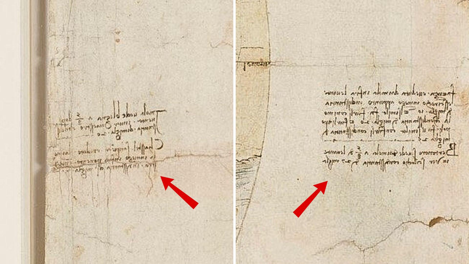
Source: Royal Collection Trust
The map even features the renaissance man’s famous mirror-script. The different directions of the wind and instructions to nearby towns were written in backwards-code and could only be read when held up to a mirror.
Only the Beginning
The Plan of Imola might have been the first of DaVinci’s aerial maps, but it certainly wasn’t the last. He went on to plot several other renaissance cities while working for Cesare Borgia.
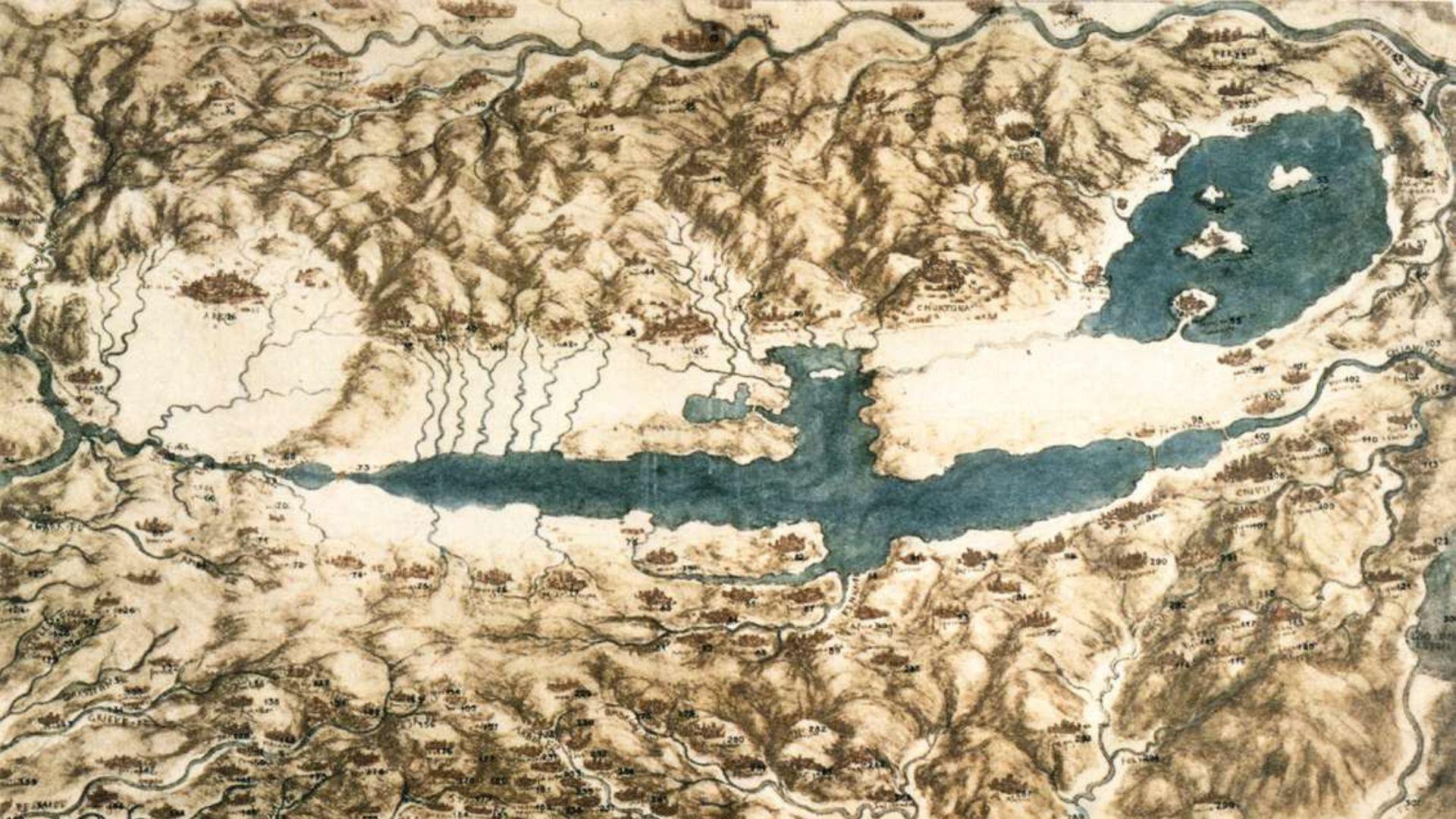
Source: Wikimedia Commons
His maps of Italy included the towns of Cesena, Urbino, Rimini, and Pesaro. He even ventured into topography, creating the famous map of the Chiana valley in Tuscany.
The Birth of Modern Cartography
The combination of mathematical accuracy with unique artistic style makes DaVinci’s Plan of Imola a map-making masterpiece.
Source: Wikimedia Commons
This first ichnographic map set the standard moving forward. The “birth of modern cartography” is credited to renaissance men like DaVinci who were able to combine art, science, and engineering. Just another thing to add to the long list of DaVinci’s contributions to humanity.